Billie Claire Handmade
Richmond, VA Neighborhood Map White - 8x10 unframed
Richmond, VA Neighborhood Map White - 8x10 unframed
Couldn't load pickup availability
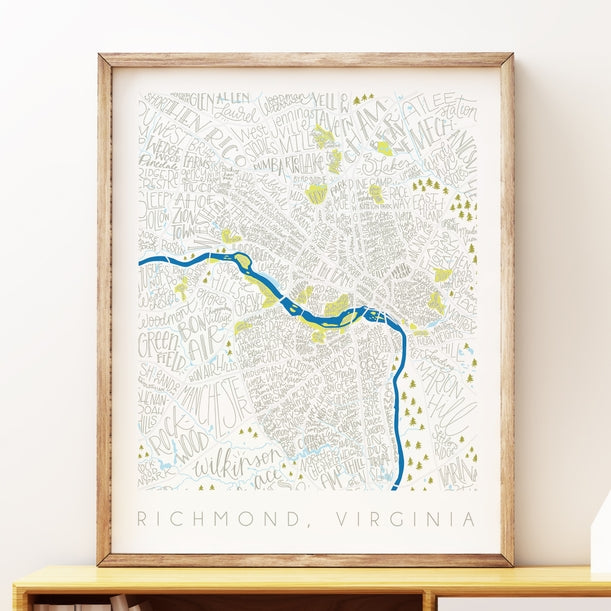
Richmond, VA Neighborhoods Map White // 8x10 Art Print Each art print is professionally printed on 110# silk coated cover stock, achieving vibrant and well-saturated colors. Prints are packaged with a 1/16” backing board in a clear plastic art sleeve and include an info insert in the back with details about the artist and print size.
All Billie Claire print sizes match standard US frame sizes, so there is no custom framing needed. This original design was hand drawn with pencil and pen, and all Billie Claire products are printed in the US / designed and assembled in Richmond, Virginia.
- Print description: A map of the Richmond, Virginia neighborhoods, including major roadways and the James River. Tags: Made in RVA, housewarming, hand lettered map, The Fan, Museum District, Shockoe Bottom, West End, Forest Hill, Church Hill, North Side